
Overview
Al Diriyah Landscape
DETAILS
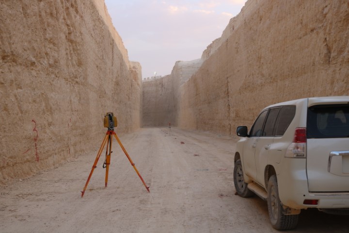
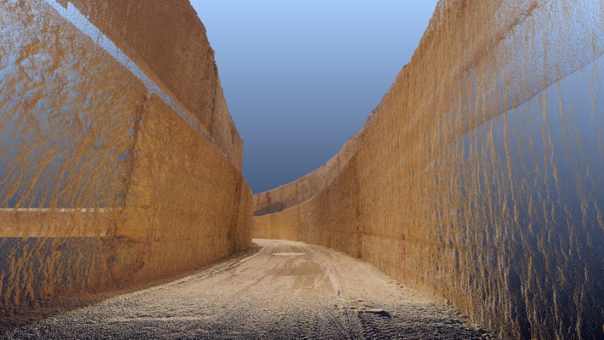
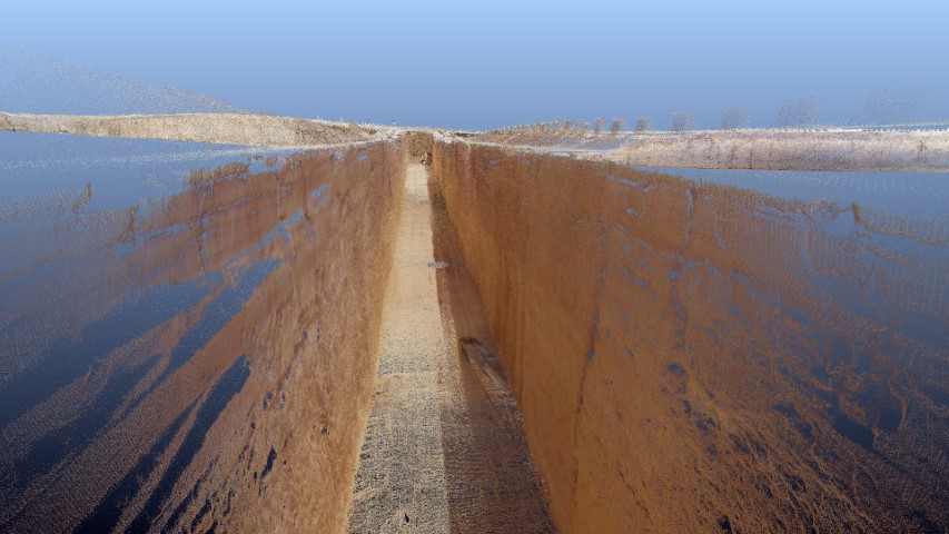
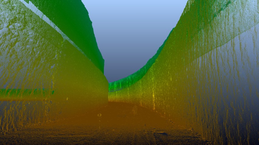
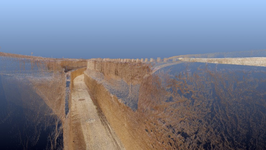
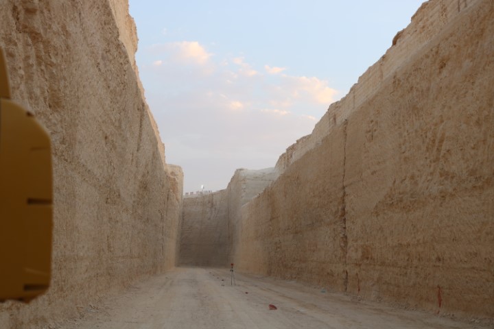
This is an as-built survey of artificial river running for 1.3 Km. The owner needed this study to check cut and fill quantities and the accuracy of the river bath alignment. GPS signal was obstructed inside the river bath. So, a dual use of the 3D scanner and LiDAR drone were utilized to create make this as built.
DELIVERABLES
-Point cloud -Contour maps in CAD formats (DXF/LAS/DEM). -2D Plan. -Quantity surveying
OWNER
ElSeif Contracting
LOCATION
Riyadh, KSA
Project Name