
Manaseib Company offers a wide array of services, from Point Cloud 3D Models to 2D & 3D CAD Documentation and more ...
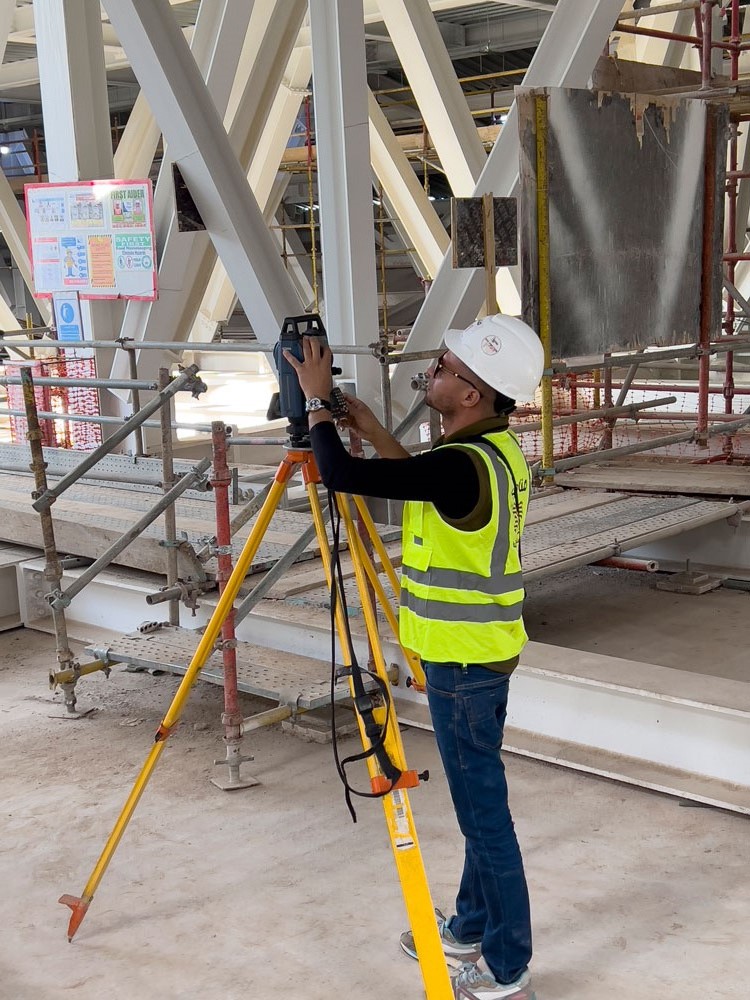
All our servicesThe terrestrial survey provides a comprehensive perspective that assists in identifying potential faults and problems. This enhances our ability to design efficiently a...
Read More!
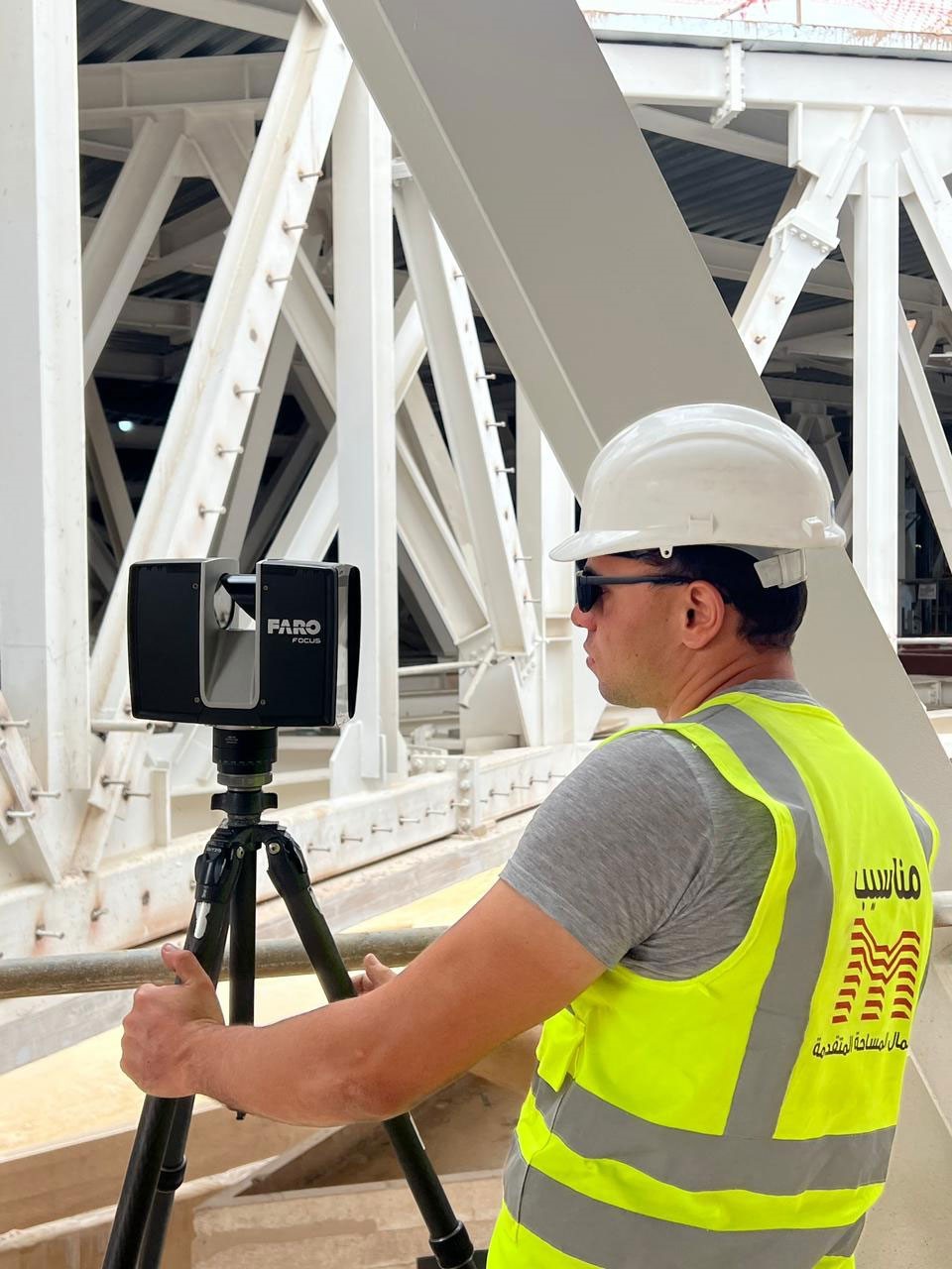
Discover 3D laser scanning technologies with our diverse range of multi-purpose, easily transportable devices that are the perfect choice for designers, projects, and d...
Read More!
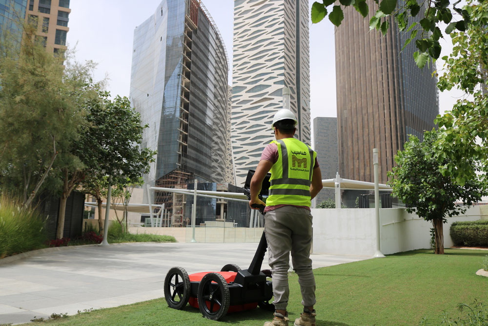
Specialised in precise detecting and mapping for underground utilities, Archaeological Sites, Military Services and Concrete Scanning in both 3D Models and 2D drawing...
Read More!
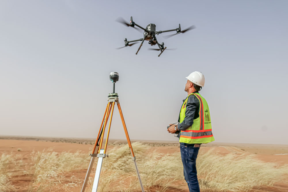
Drone surveying services provide accurate site 3D models and maps, along with comprehensive visualization and precise data for topographic analysis. They are highly e...
Read More!
manasib, a company specializing in 3D scanning, aerial photography, and underground service detection, prides itself on quality and precision. With an enthusiastic team, we strive to earn our clients trust by offering innovative solutions for major projects.
We are more than just a surveying team, our team of professional land surveyors passionate about one thing, our commitment to provide our clients, with certainty they can trust every time.

about one thing, our commitment to provide our clients, with certainty they can trust every time.
We are more than just a surveying team, our team of professional land surveyors passionate
about one thing, our commitment to provide our clients, with certainty they can trust every time.

As a consulting firm of engineers specializing in Engineering Surveying, 3D Modeling, DTM (digital terrain model), Orthophoto, Point Cloud, DSM (digital surface model) with more than 15 years of experience in these fields, we intervene to assist our clients, engineering firms, civil work companies, public firms, industrial operators, the Military and the Administration, in all their projects with perpetually added value recognized. We believe that Manaseib is able to offer the best blend of in-depth sector expertise, a proven ability to quickly comprehend the client’s core business needs. Our best feature is our global team of highly professional and knowledgeable individuals, who, through their hard work, passion, dedication and perceptiveness, continuously drive our firm forward. All our teams work to implement innovative and high-performance solutions to help our clients in Egypt, Saudi Arabia, and Jordan.
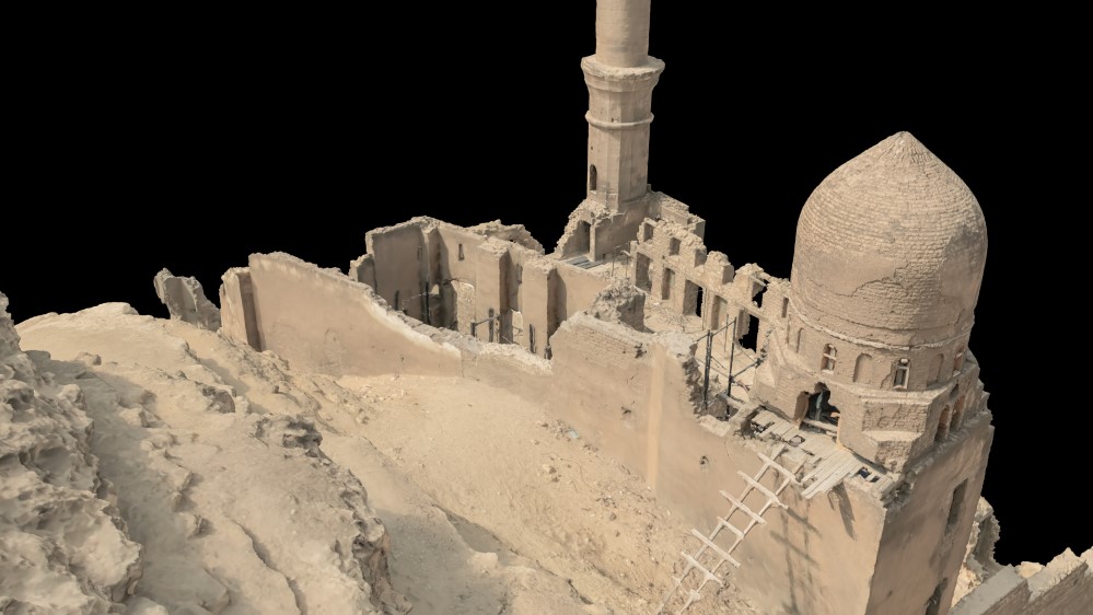
A detailed survey of this archaeological site to restore its integrity and stability
Read More!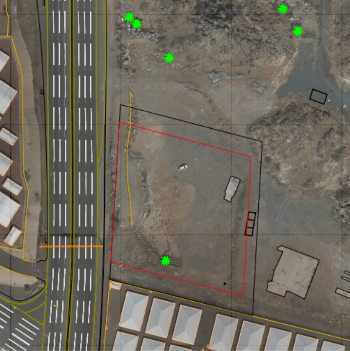
surveying and mapping process for the site to provide and improve the site and way
Read More!
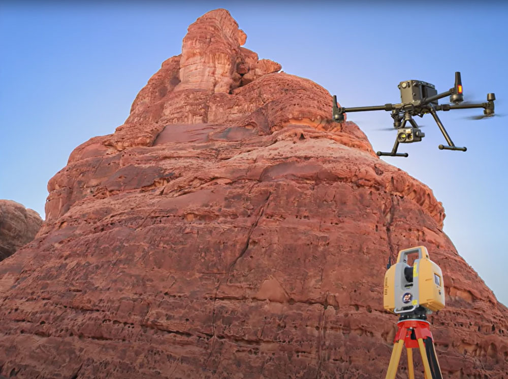
A comprehensive survey combining aerial methods, 3D laser scanning, and ground assessments, utilizing a handheld scanner to evaluate slope stability.
Read More!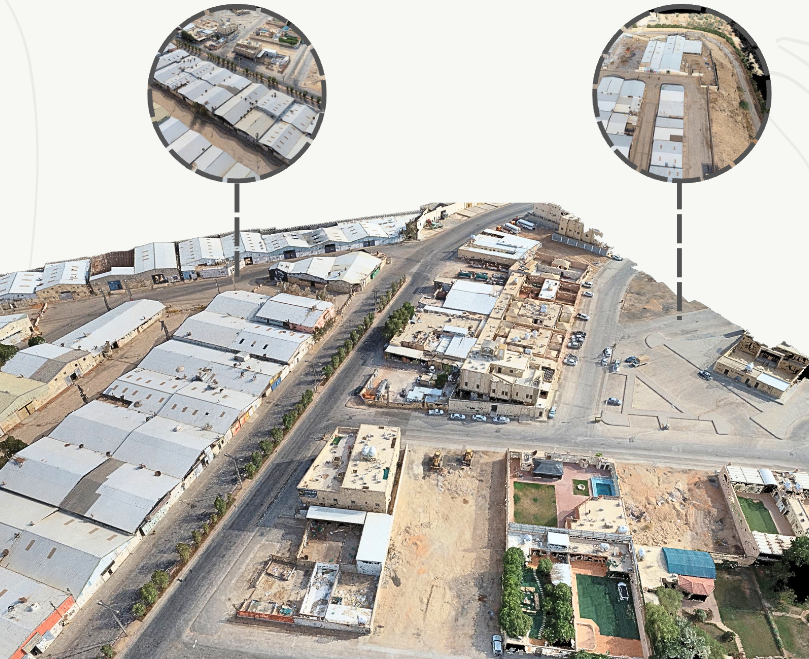
Hybrid As-built aerial survey and ground survey of the project site, to study the stability of the slopes.
Read More!
We will get back to you within 24 hours
Follow our latest news and thoughts which focuses exclusively on insight,industry trends, top news headlines.
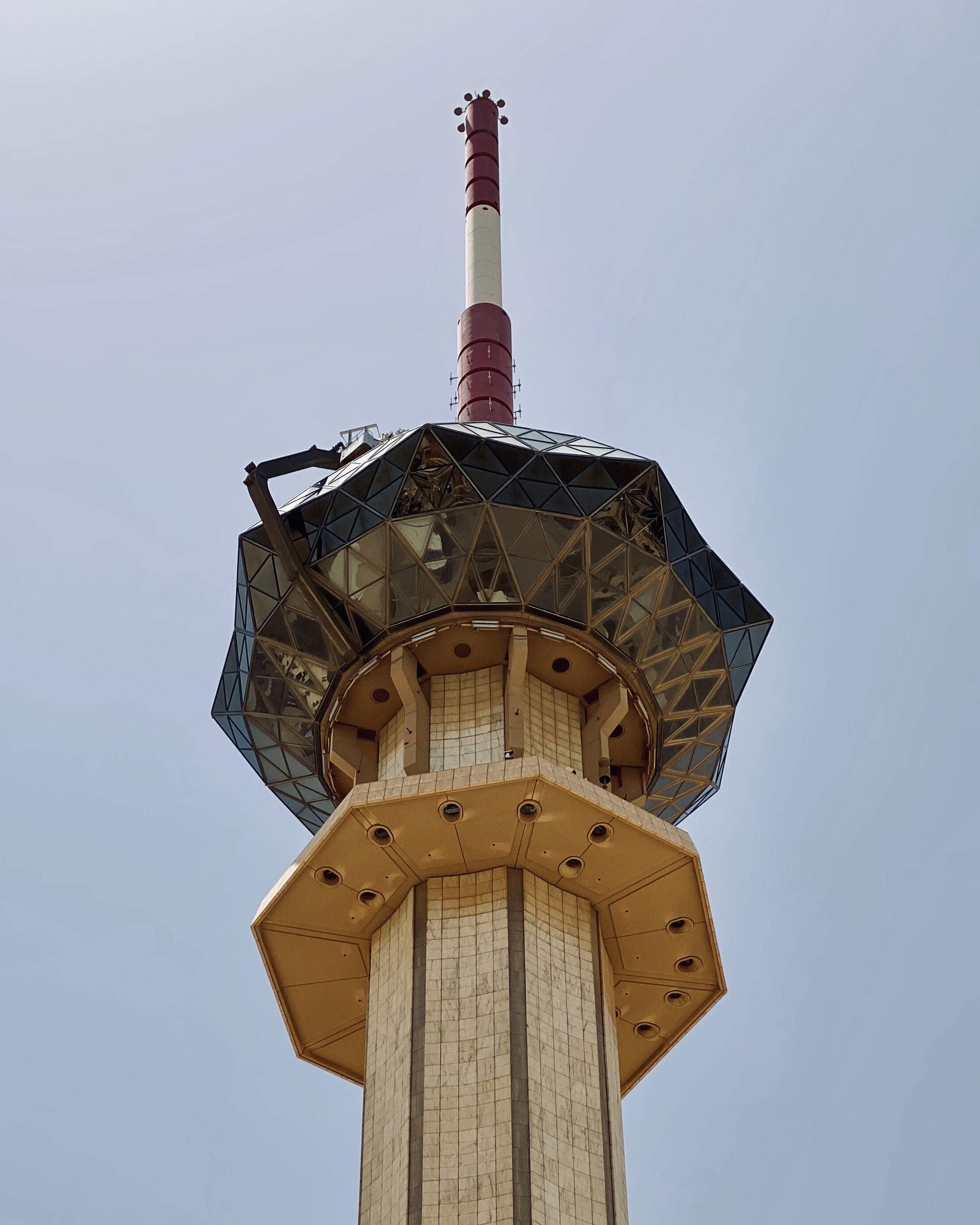
A complete survey of the Radio and Television Corporation buildings and the general location of the...
Read More!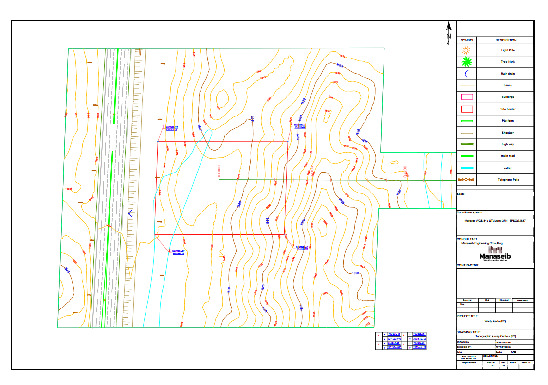
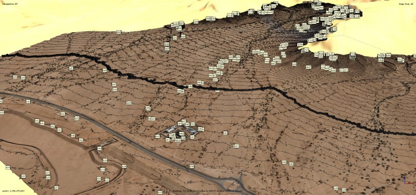
Upcoming Survey of 15 kilometers from wady arada to get contour and grid map by capturing a total of...
Read More!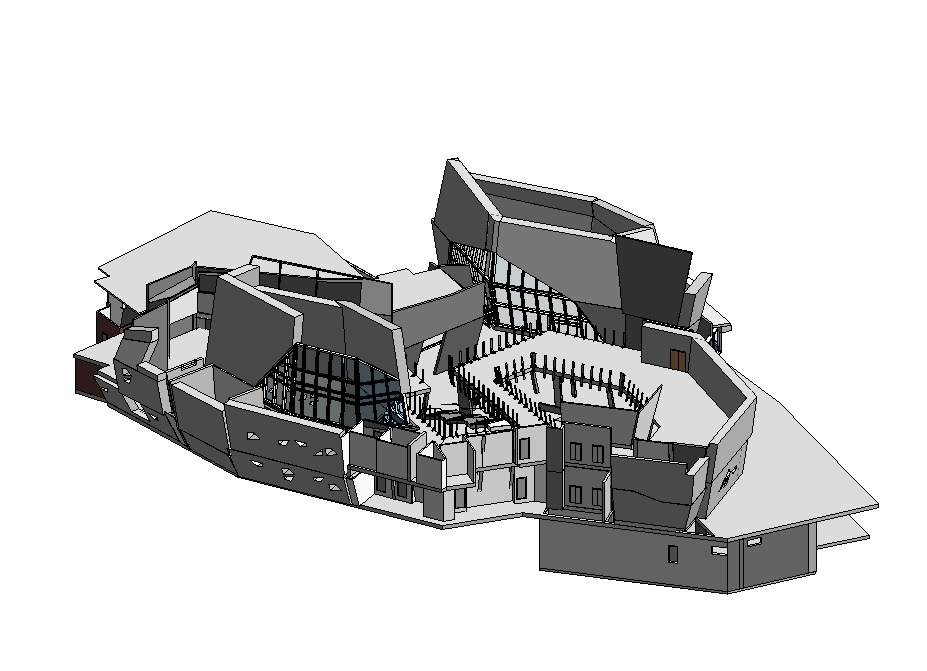
Upcoming Project that we making aerial survey to get a point cloud with real dimension to renovate b...
Read More!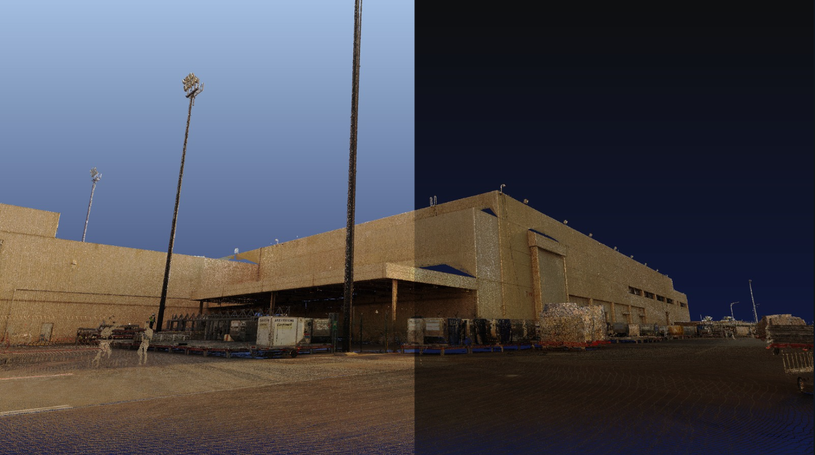
new project upcoming an aerial survey for the exterior of Al Dammam airport for maintenance and re...
Read More!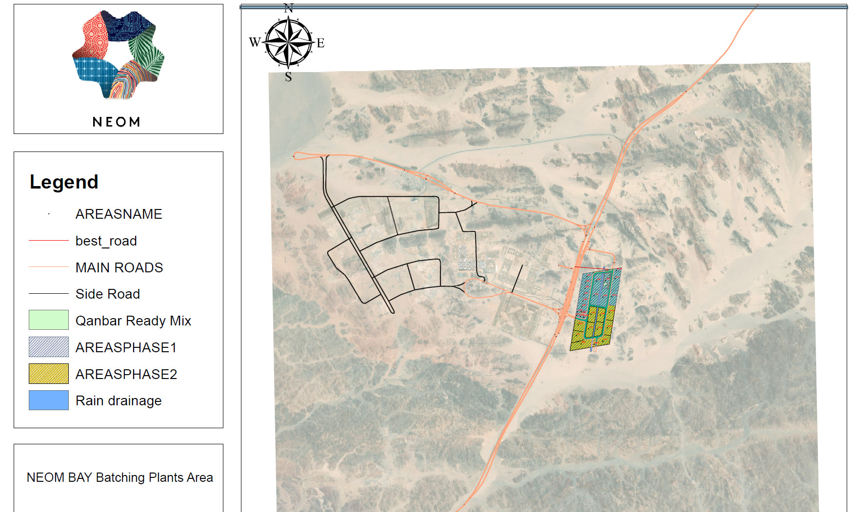
GIS is a powerful tool for analyzing spatial data and making informed decisions by linking data to...
Read More!